Shelter Map VE
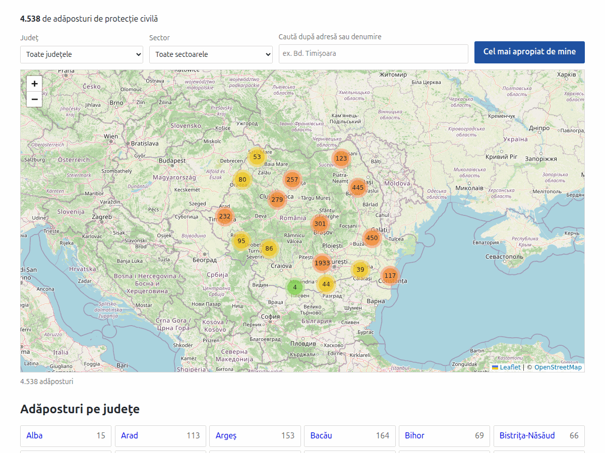
Romania's 4,538 civil protection shelters on a clustered Leaflet map. WordPress plugin, no API key.
by nextdoorentertainment · github.com/spiri439/shelter-map-ve · website
Install
The author publishes release zips, so WP-CLI can install straight from GitHub:
wp plugin install https://github.com/spiri439/shelter-map-ve/releases/download/v1.0.0/shelter-map-ve.zipReadme
Shelter Map VE
A WordPress plugin that puts the 4,538 civil protection shelters of Romania on a clustered Leaflet map — with county and sector filtering, diacritic-insensitive search and a nearest-shelter lookup.
No map API key. No billing account. No database tables, no queries, no cookies, no settings page.
Why
It was written to replace WP Google Maps on a site that had the shelter registers in it. The old setup pulled in 14 JavaScript files (650 KB uncompressed) plus the Google Maps JavaScript API, and fetched the markers over a REST round trip. This ships ~130 KB gzipped in total, all static and cacheable, and the map only loads once it nears the viewport.
Install
Download shelter-map-ve.zip from the latest release and upload
it under Plugins → Add New → Upload Plugin, or drop the folder into
wp-content/plugins/.
Then put the shortcode in a page:
[smve_map]Attributes, all optional:
| Attribute | Default | Meaning |
|---|---|---|
height |
600 |
map height in pixels (300–1200) |
zoom |
6 |
initial zoom level |
lat, lng |
44.109417, 24.359083 |
initial centre |
zoom, lat and lng set the view shown before the shelters arrive; once they have, the
map frames whatever is currently displayed.
What it does
- Clusters every shelter, so several thousand markers stay usable on a phone.
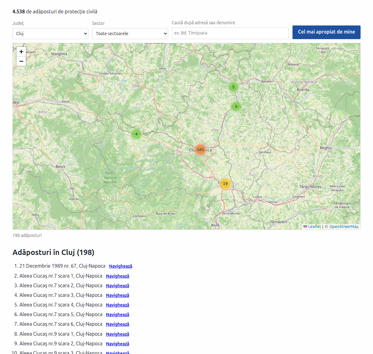
- Filters by county, and by sector inside Bucharest.
- Searches shelter names and addresses without caring about diacritics —
timisoarafindsTimișoara. - Finds the nearest shelter to the visitor, across the whole set rather than the current filter, and shows the distance.
- Gives every shelter a directions link that opens the visitor's own maps app.
- Renders the county navigation and, at
?county=<slug>, that county's full list on the server — so both work without JavaScript and are indexable.
How the data is built
Each shelter carries only a name, an address and coordinates. The county is not parsed out of the address — matching on text gets it right about 42% of the time and trips over street names — it is computed offline by point-in-polygon against Romanian county boundaries and shipped inside the data files. Nothing is computed at runtime.
The pipeline lives in build/ and is deterministic: re-running it on
unchanged input reproduces byte-identical output.
sh      build/fetch-boundaries.sh     # county polygons, ~32 MB, not committed
python3 build/build-data.py           # source-data/markers-raw.tsv -> data/*.json
python3 build/make-mo.py              # languages/*.po and *.mo
php     tests/render-test.php         # 27 assertions, no WordPress needed
python3 build/make-zip.py             # dist/shelter-map-ve.zip
Data quality
The source registers are not error-free. Thirteen records name a Bucharest sector in their
own address but sit outside Bucharest on the map, and the corruption is systematic — the
integer part of the latitude or longitude is one too high (45.44229,27.13429 where
44.44226,26.13433 was meant). Twelve were re-geocoded against OpenStreetMap and verified
on street, sector and house number; one could not be found and kept its original
coordinates.
That rule only catches the Bucharest cases. A full audit of all 4,538 geocodes has not been done, and it is likely that other counties carry similar errors. Corrections are welcome through the issue tracker.
Requirements
WordPress 5.8+, PHP 7.4+. No Composer, no npm, no build step for the plugin's own code.
Licence
MIT — see LICENSE, which also covers the bundled Leaflet and Leaflet.markercluster and credits the boundary data.
Read the full README on GitHub →
Releases
| Tag | Published | Asset | Downloads |
|---|---|---|---|
| v1.0.0 | Sep 8, 2026 | shelter-map-ve.zip | 1 |